


Maps
(Uploaded 13/12/23)
.jpg) The maps designs found on Wileman and Shelley china were introduced and registered, not by the pottery, but Arthur J. Potts of Ventnor, on the Isle of Wight. In 1880, at age 24, he opened a china and glass shop at 13 Mill Street, Ventnor, later to be renamed Pier Street. Noted in records at the Ventnor Heritage Museum, the shop sold not only china and glass, but stationery and novelty goods. He was an enterprising trader and living on the busy holiday resort island, saw the value of tourist souvenirs. He formed a trading relationship with Wileman and on 3 January 1903 he registered a design for a map of the Isle of Wight, with a banner ribbon proclaiming the “Garden Isle”, to be used on a variety of china shapes. These were produced with either a green map with a pink ribbon or a pink map with a green ribbon. Becoming a distributor, taking orders from novelty ware sellers in other resorts, the Channel Islands and South Coast attractions quickly followed.
The maps designs found on Wileman and Shelley china were introduced and registered, not by the pottery, but Arthur J. Potts of Ventnor, on the Isle of Wight. In 1880, at age 24, he opened a china and glass shop at 13 Mill Street, Ventnor, later to be renamed Pier Street. Noted in records at the Ventnor Heritage Museum, the shop sold not only china and glass, but stationery and novelty goods. He was an enterprising trader and living on the busy holiday resort island, saw the value of tourist souvenirs. He formed a trading relationship with Wileman and on 3 January 1903 he registered a design for a map of the Isle of Wight, with a banner ribbon proclaiming the “Garden Isle”, to be used on a variety of china shapes. These were produced with either a green map with a pink ribbon or a pink map with a green ribbon. Becoming a distributor, taking orders from novelty ware sellers in other resorts, the Channel Islands and South Coast attractions quickly followed.
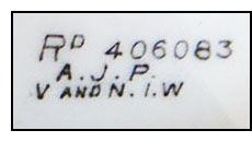 Seeing the success of this experiment, Potts went on to eventually register 87 maps, across the United Kingdom, the last on 27 June 1904. Most items were small souvenir pieces but table ware is known and each piece bore the registration number and either “A.J.P. V. and N.I.W.” – short for Arthur J. Potts, Ventnor and Newport, Isle of Wight, (he also had premises at Newport), and/or the name of the local trader.
15 maps are known without registration numbers, some UK and others for Canada and USA.
It has been noted that many pieces have the wrong registered number applied to the base. The maps and their numbers illustrated have been verified from Registration records and the Shelley pattern books.
Seeing the success of this experiment, Potts went on to eventually register 87 maps, across the United Kingdom, the last on 27 June 1904. Most items were small souvenir pieces but table ware is known and each piece bore the registration number and either “A.J.P. V. and N.I.W.” – short for Arthur J. Potts, Ventnor and Newport, Isle of Wight, (he also had premises at Newport), and/or the name of the local trader.
15 maps are known without registration numbers, some UK and others for Canada and USA.
It has been noted that many pieces have the wrong registered number applied to the base. The maps and their numbers illustrated have been verified from Registration records and the Shelley pattern books.
Some Maps were used for other locations in the same geographical area and are marked with an asterisk (*). Please see Notes below.
Aberdovey*
Aberystwyth
Bangor*
Barmouth
Barrow
Bay of Fundy (Can.)
Beautiful Jersey
Belfast
Blackpool
Bridlington
Brighton*
Builth Wells*
Camden Maine USA
Cardiff*
Carmarthen
Carnarvon
Chepstow & Wye Valley*
Hawarden
Christchurch
Clacton on Sea
Colwyn Bay
Conway
Cork Harbour
Criccieth*
Dartmouth
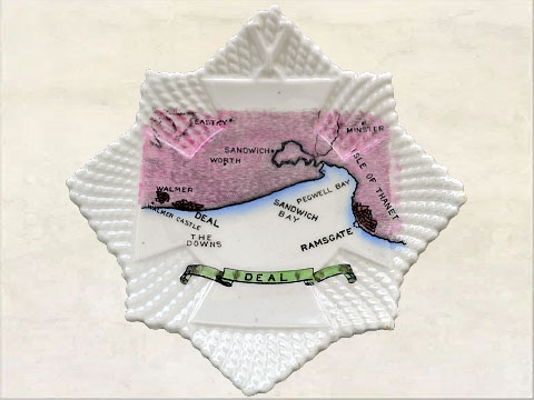
Deal*
Dover
Dublin Bay
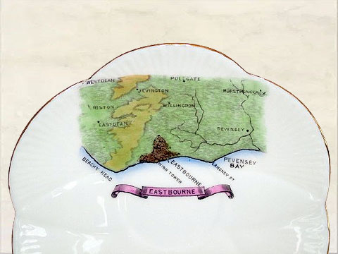
Eastbourne
Falmouth
Filey
Firth of Forth
Firth of Tay
Fleetwood
Gananoque (Can.)
Garden Isle*
Gem of the Channel*
Great Yarmouth*
Harwarden*
Hastings*
Haverfordwest
Hereford
Hunstanton
Inverness
Ipswich
Isle of Bute
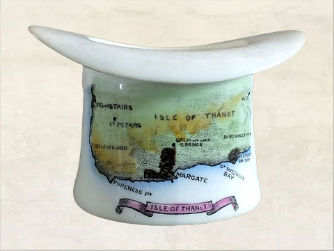
Isle of Thanet
Lampeter
Llandudno
Loch Lomond
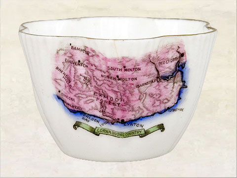
Lorna Doone Country*
Lovely Guernsey
Ludlow
Lytham*
Malvern
Mona's Isle
Montrose
Morcambe
Muskoka Lakes (Can.)
Nanepashemet (USA)*
Newfound Lake(USA)
Oban
Paignton*
Pennaenmawr
Penzance
Peterborough (Can.)
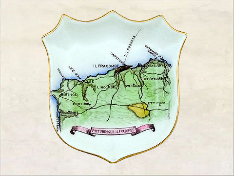
Picturesque Ilfracombe
Plymouth
Portsmouth
Pwllheli
Queen of the West*
Ringwood*
Sandgate*
Scarborough
Sherbrooke(Can.)
Snowdonia
Southampton
Sunderland
Swanage
Swansea*
Teignmouth
Tenby
The English Lakes (1)*
The English Lakes (2)*
The Thames
The Caledonian Canal
The Clyde
The Evergreen Valley*
The Highlands
The Humber
The Lakes of Killarney
The Land Of Shakespeare
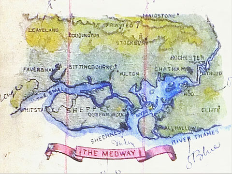
The Medway
The Mersey
The Severn
The Tees
The Tyne
The Vale of Clwyd
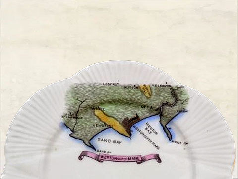
Weston Super Mare
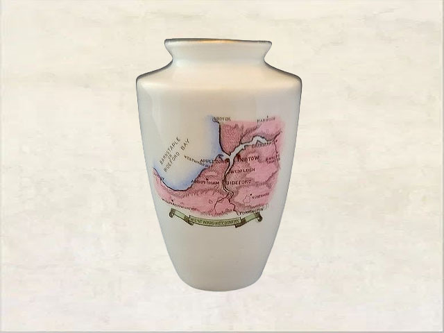
Westward Ho Country
Weymouth
Whitby
Worthing
OR
< Click/tap on the images below for an enlarged view >
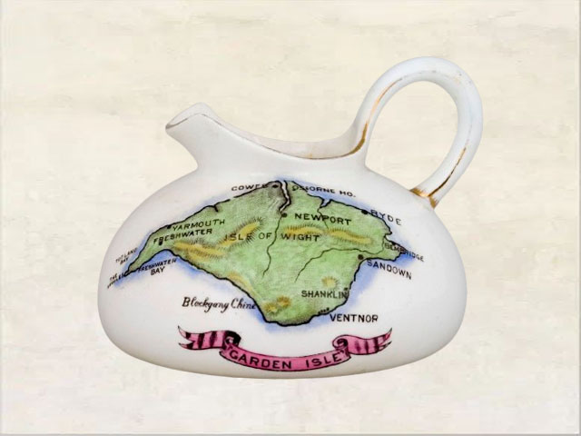
Rd.400929Garden Isle*
 Rd.403011
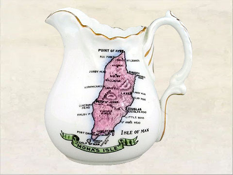
Mona's Isle*
 Rd.406082
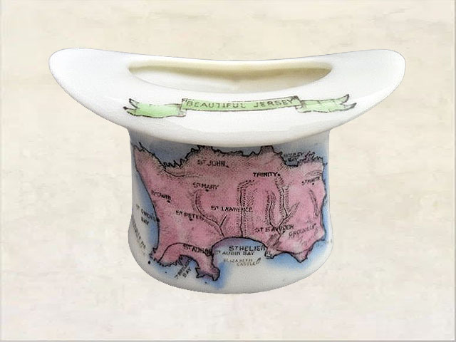
Beautiful Jersey
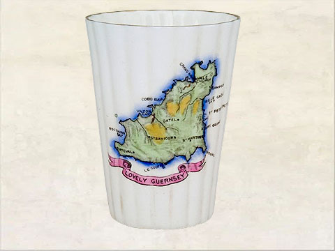 Rd.406083
Lovely Guernsey
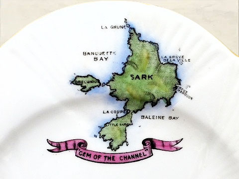 Rd.406084
Gem of the Channel*
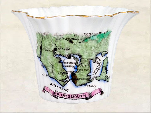 Rd.407143
Portsmouth*
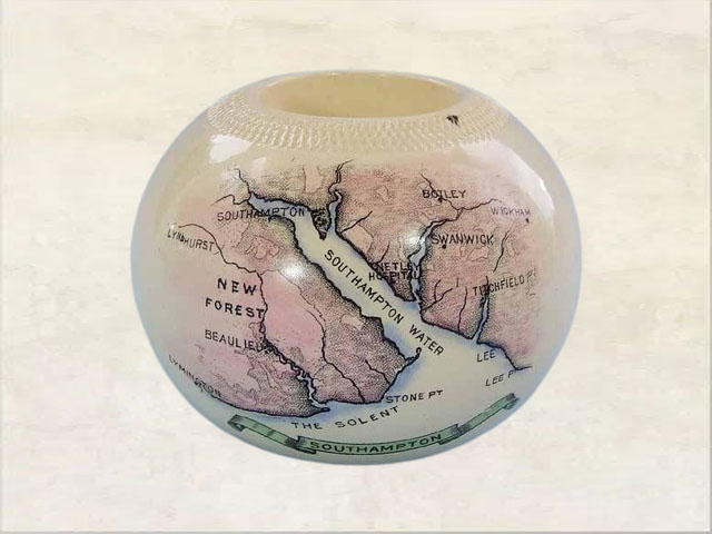 Rd.407144
Southampton
 Rd.407845
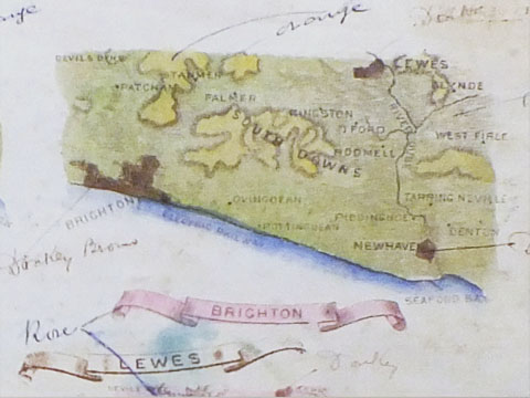
Brighton*
 Rd.407846
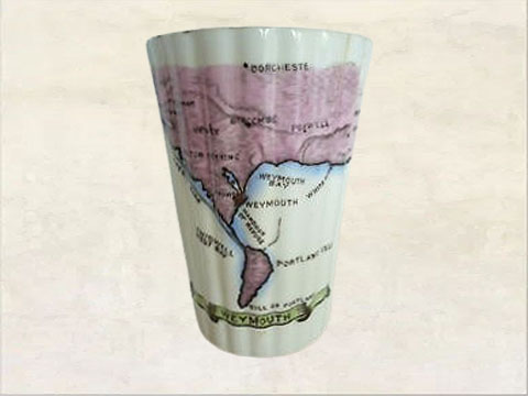
Weymouth
 Rd.407847
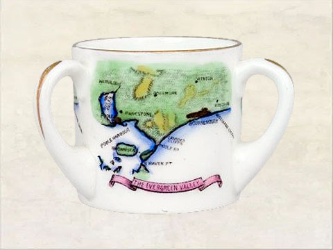
The Evergreen Valley*
 Rd.407848
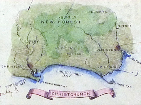
Christchurch
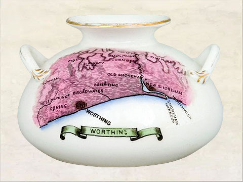 Rd.407849
Worthing
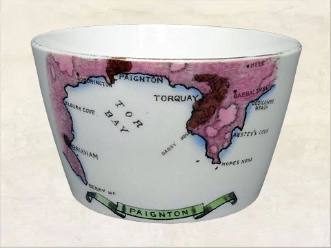 Rd.407989
Paignton*
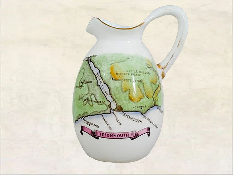 Rd.407990
Teignmouth
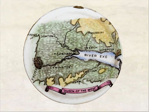 Rd.407991
Queen of the West*
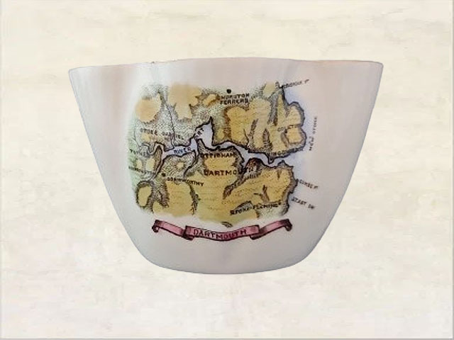 Rd.408137
Dartmouth
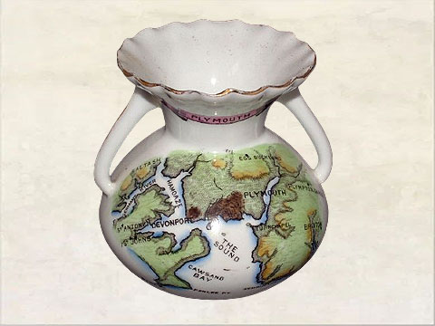 Rd.408138
Plymouth
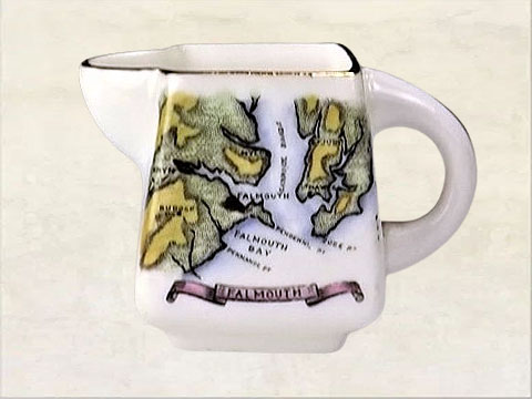 Rd.408139
Falmouth
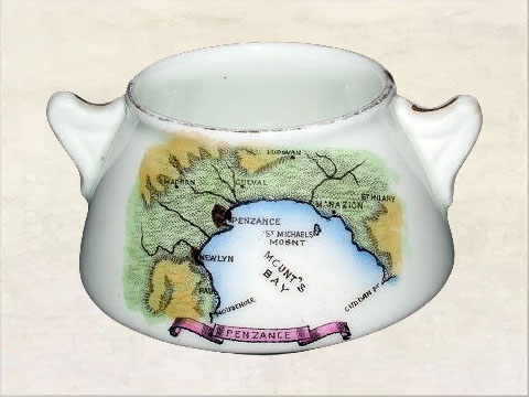 Rd.408487
Penzance
 Rd.408488
Westward Ho Country*
 Rd.408489
Picturesque Ilfracombe
 Rd.408694
Eastbourne
 Rd.408861
Weston Super Mare
 Rd.408862
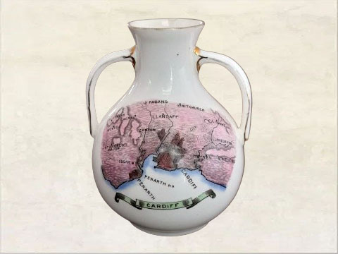
Cardiff*
 Rd.408863
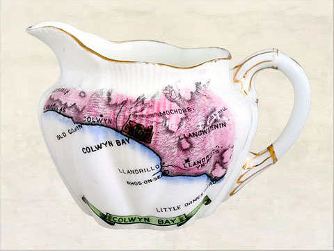
Colwyn Bay
 Rd.408864
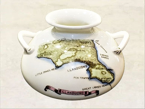
Llandudno
 Rd.408865
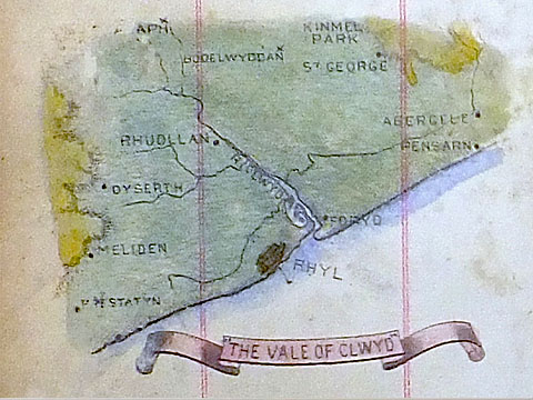
The Vale of Clwyd
 Rd.408866
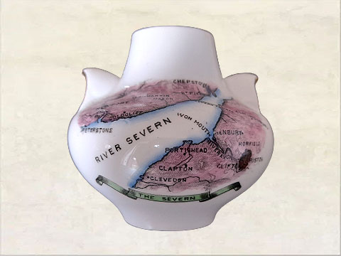
The Severn
 Rd.409435
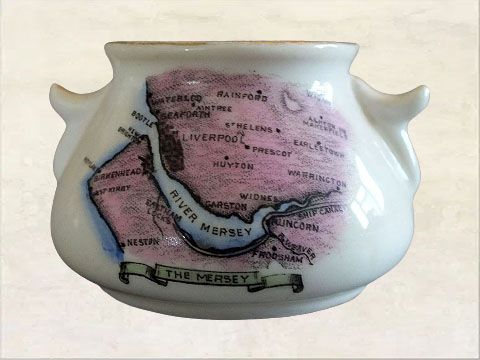
The Mersey
 Rd.409598
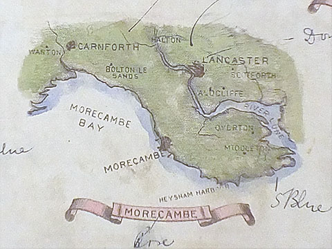
Morcambe
 Rd.409599
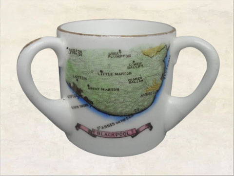
Blackpool
 Rd.409600
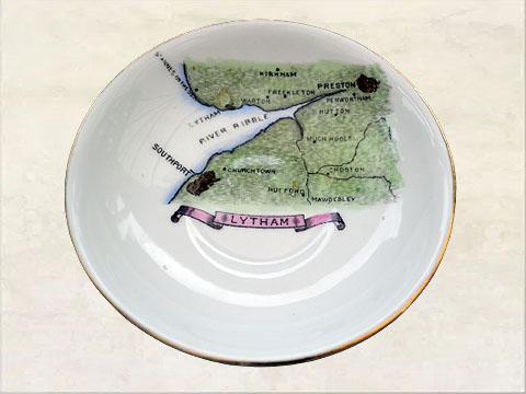
Lytham*
 Rd.409601
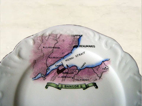
Bangor*
 Rd.409602
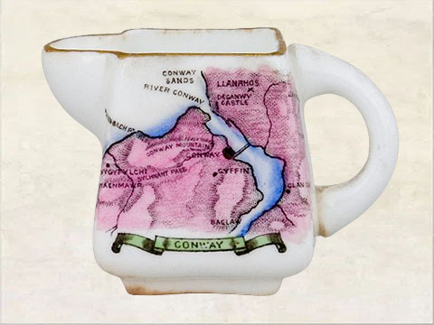
Conway
 Rd.409603
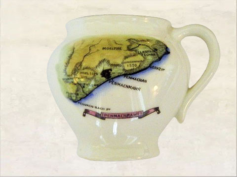
Pennaenmawr
 Rd.409604
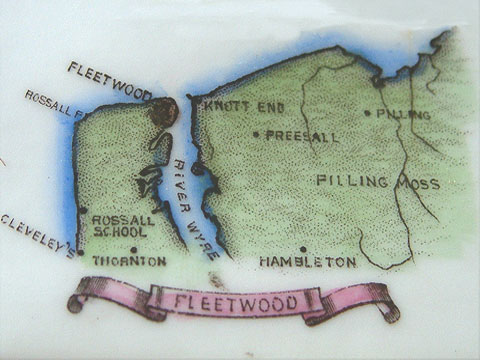
Fleetwood
 Rd.409605
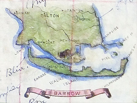
Barrow
 Rd.410234
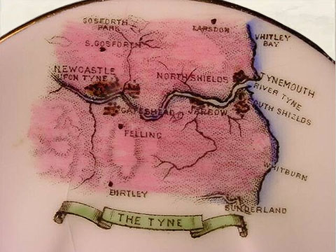
The Tyne
 Rd.410235
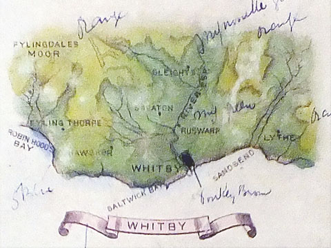
Whitby
 Rd.410236
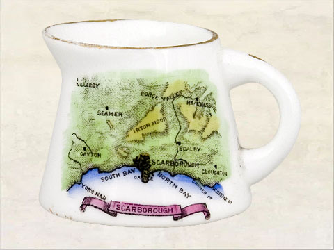
Scarborough
 Rd.410237
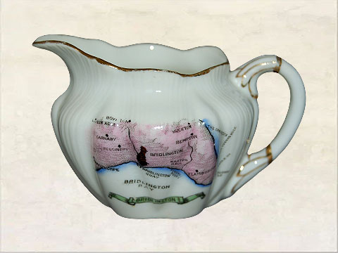
Bridlington
 Rd.410238
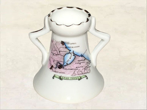
The Tees
 Rd.410239
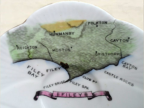
Filey
 Rd.410240
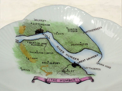
The Humber
 Rd.410241
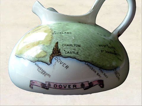
Dover
 Rd.410242
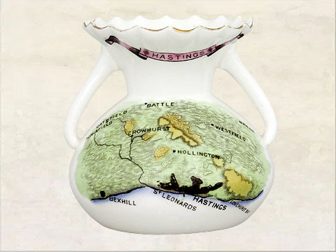
Hastings*
 Rd.410243
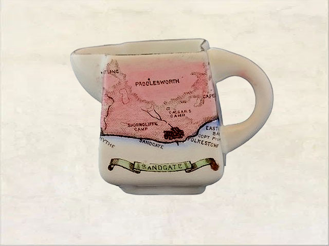
Sandgate*
 Rd.411194
Isle of Thanet
 Rd.411195
The Medway
 Rd.411196
Deal*
 Rd.411377
Lorna Doone Country*
 Rd.411895
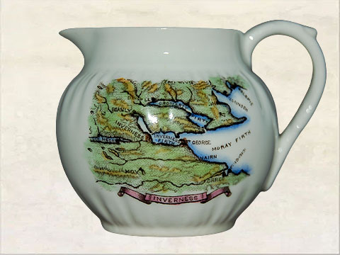
Inverness
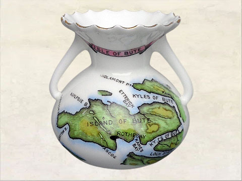 Rd.411896
Isle of Bute
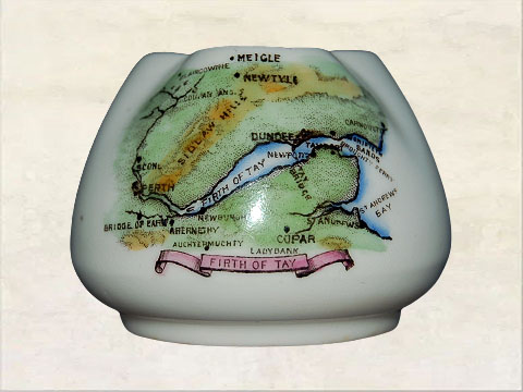 Rd.411897
Firth of Tay
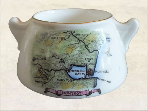 Rd.411898
Montrose
 Rd.411899
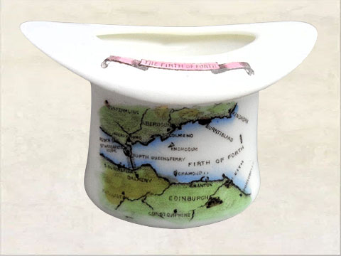
Firth of Forth
 Rd.411900
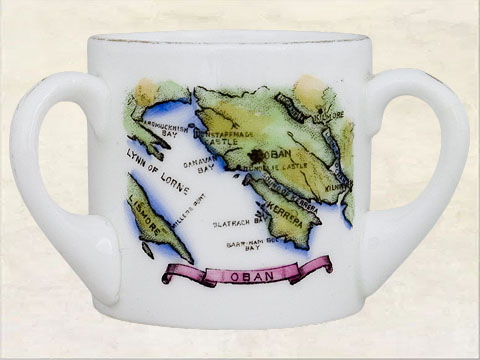
Oban
 Rd.411901
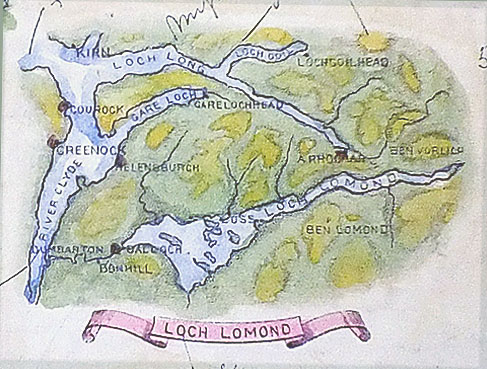
Loch Lomond
 Rd.411902
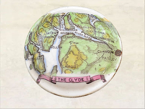
The Clyde
 Rd.412173
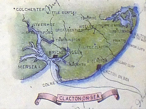
Clacton on Sea
 Rd.412174
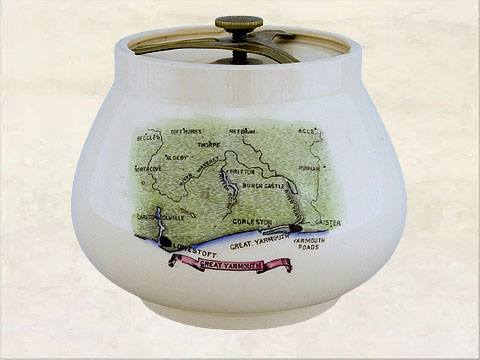
Great Yarmouth*
 Rd.412175
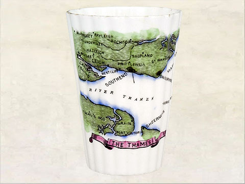
The Thames
 Rd.412176
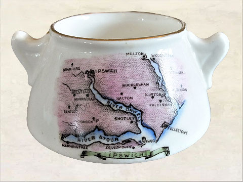
Ipswich
.jpg) Rd.412177
Rd.412177The English Lakes (1)*
.jpg) Rd.412178
Rd.412178The English Lakes (2)*
 Rd.412179
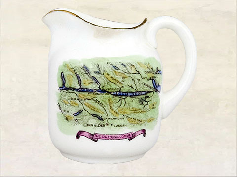
The Caledonian Canal
 Rd.412805
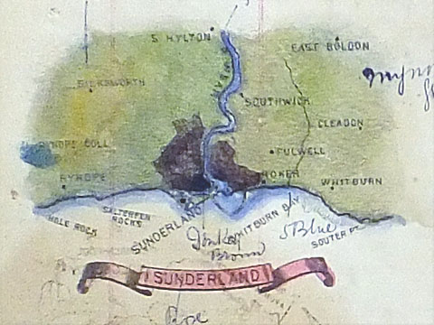
Sunderland
 Rd.413305
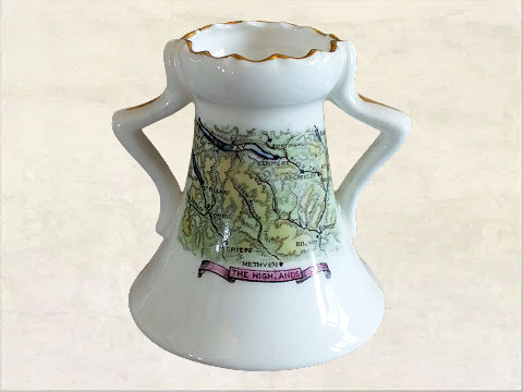
The Highlands
 Rd.426411
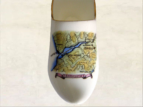
Barmouth
 Rd.426412
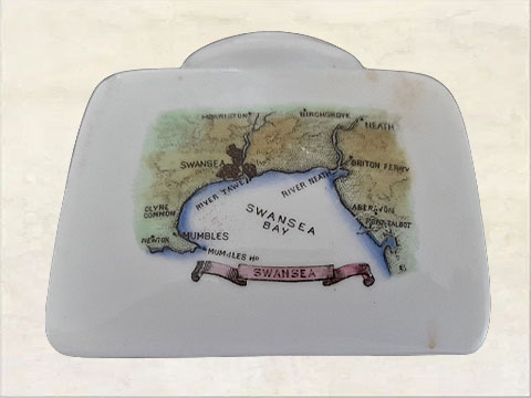
Swansea*
 Rd.426413
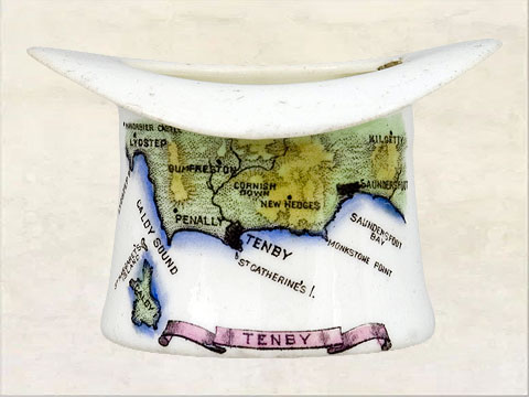
Tenby
 Rd.426414
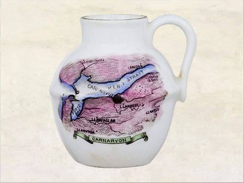
Carnarvon
 Rd.426591
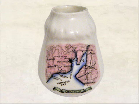
Criccieth*
 Rd.426708
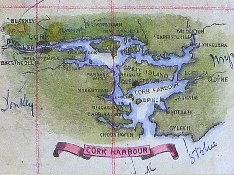
Cork Harbour
 Rd.426709
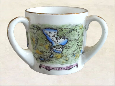
The Lakes of Killarney
 Rd.426710
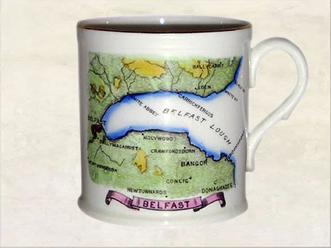
Belfast
 Rd.426711
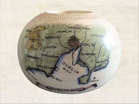
Dublin Bay
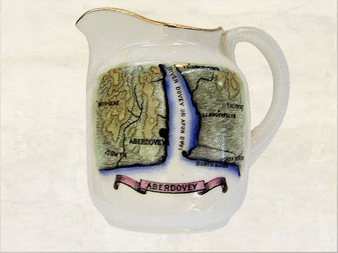 Rd.428155
Aberdovey*
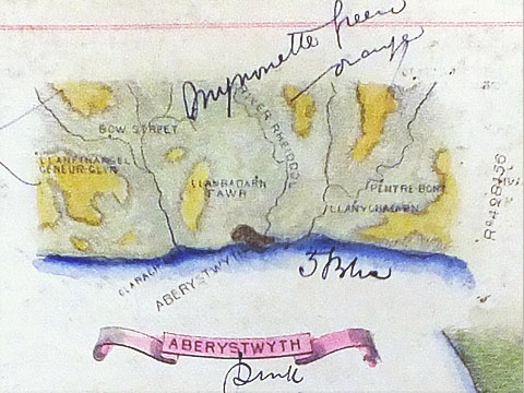 Rd.428156
Aberystwyth
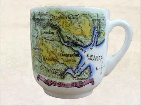 Rd.428596
Carmarthen
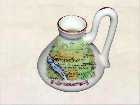 Rd.430627
Chepstow & Wye Valley*
 Rd.430628
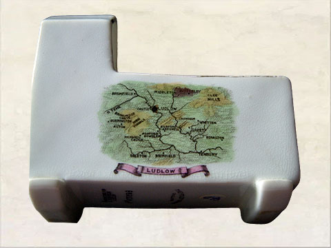
Ludlow
 Rd.430773
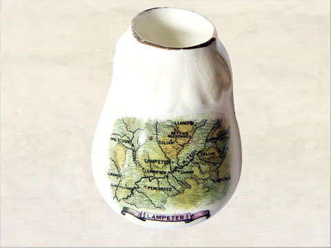
Lampeter
 Rd.430993
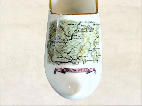
Builth Wells*
 Rd.432423
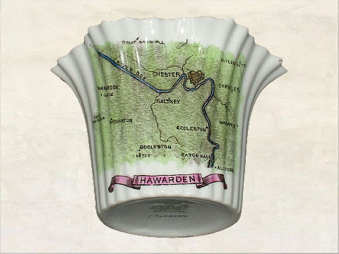
Hawarden*
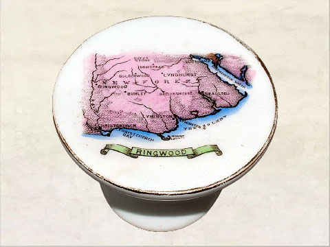 Rd.435503
Ringwood*
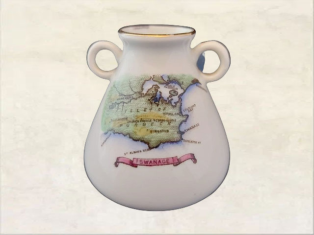 Rd.435557
Swanage
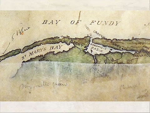 Rd.(unregistered)
Bay of Fundy (Can.)
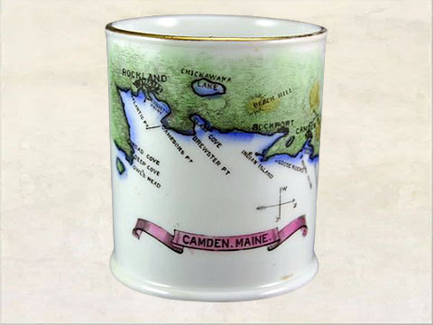 Rd.(unregistered)
Camden Maine (USA)
 Rd.(unregistered)
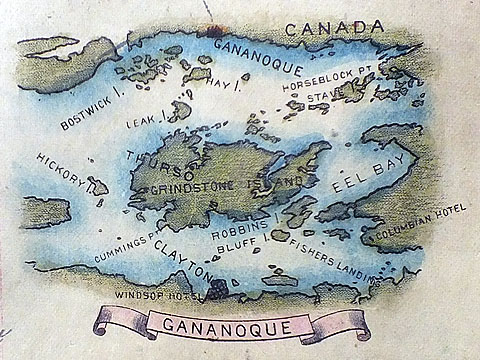
Gananoque (Can.)
 Rd.(unregistered)
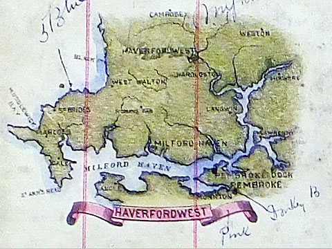
Haverfordwest
 Rd.(unregistered)
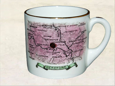
Hereford
 Rd.(unregistered)
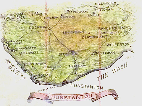
Hunstanton
 Rd.(unregistered)
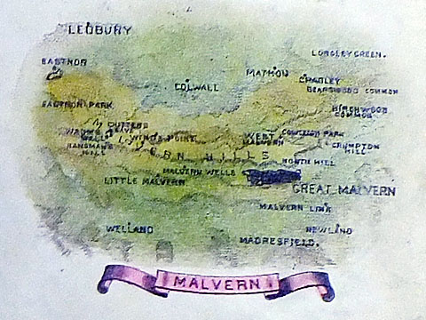
Malvern
 Rd.(unregistered)
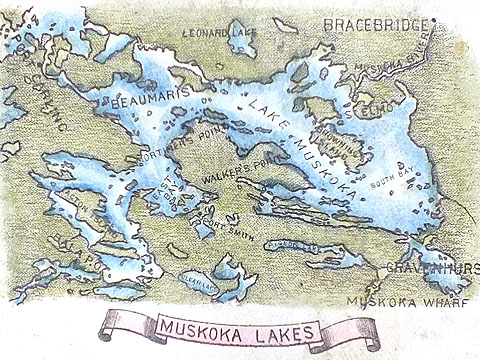
Muskoka Lakes (Can.)
.jpg) Rd.(unregistered)
Rd.(unregistered)Newfound Lake (USA)
 Rd.(unregistered)
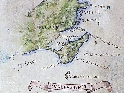
Nanepashemet (USA)
.jpg) Rd.(unregistered)
Rd.(unregistered)Peterborough (Can)
 Rd.(unregistered)
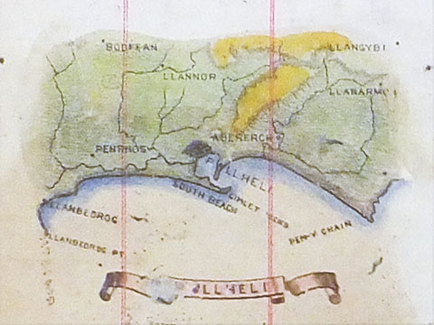
Pwllheli
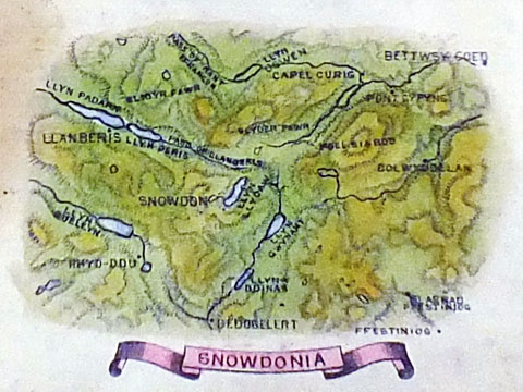 Rd.(unregistered)
Snowdonia
.jpg) Rd.(unregistered)
Rd.(unregistered)Sherbrooke (Can.)
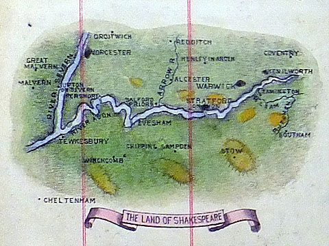 Rd.(unregistered)
The Land of Shakespeare
*Notes:
(1) Rd.407143 - 'Portsmouth' was also used for 'Havant' & 'Gosport'
(2) Rd.407825 - 'Brighton' was also used for 'Lewes'
(3) Rd.407847 - 'The Evergreen Valley' was also used for 'Bournemouth' & 'Poole'
(4) Rd.407989 - 'Paignton' was also used for 'Fair Torquay'
(5) Rd.408862 - 'Cardiff' was also used for 'Penarth'
(6) Rd.409600 - 'Lytham' was also used for 'Southport'
(7) Rd.409601 - 'Bangor' was also used for 'Beaumaris'
(8) Rd.410242 - 'Hastings'was also used for 'Bexhill' & 'Sussex Coast'
(9) Rd.410243 - 'Sandgate' was also used for 'Folkestone'
(10) Rd.411196 - 'Deal' was also used for 'Ramsgate' & 'Sandwich'
(11) Rd.412174 - 'Great Yarmouth' was also used for 'Lowestoft'
(12) Rd.426412 - 'Swansea' was used also for 'Mumbles' & 'Neath'
(13) Rd.426591 - 'Criccieth' was also used for 'Portmadoc'
(14) Rd.428155 - 'Aberdovey' was also used for 'Towyn'
(15) Rd.430627 - 'Chepstow & Wye Valley' was also used for 'Ross & Wye Valley'
(16) Rd.430993 - 'Builth Wells' was also used for 'Llandrindod Wells'
(17) Rd.432423 - 'Harwarden' was also used for 'Chester'
(18) Rd.435503 - 'Ringwood' was also used for 'Lyndhurst', 'Brockenhurst', & 'Lymington'
(19) 'Unregd.' - 'Nanepashemet' was also used for 'Mablehead'
Definitions
'Garden Isle' is better known as the 'Isle of Wight'
'Evergreen Valley' refers to the Bournemouth /Poole geographical area
'Lorna Doone Country'is better known as 'Exmoor'
'Mona's Isle' is better known as the 'Isle of Man'
'Queen of the West' refers to 'Exmouth' geographical area
'Gem of the Channel' is better known as 'Sark'
'Land of Shakespeare' refers to 'Stratford on Avon' geographical area
'English Lakes (1)' refers to 'Lake Windermere' geographical area
'English Lakes (2)' refers to 'Bassenthwaite Lake' geographical area
'Westward Ho Country' refers to 'North Devon' geographical area